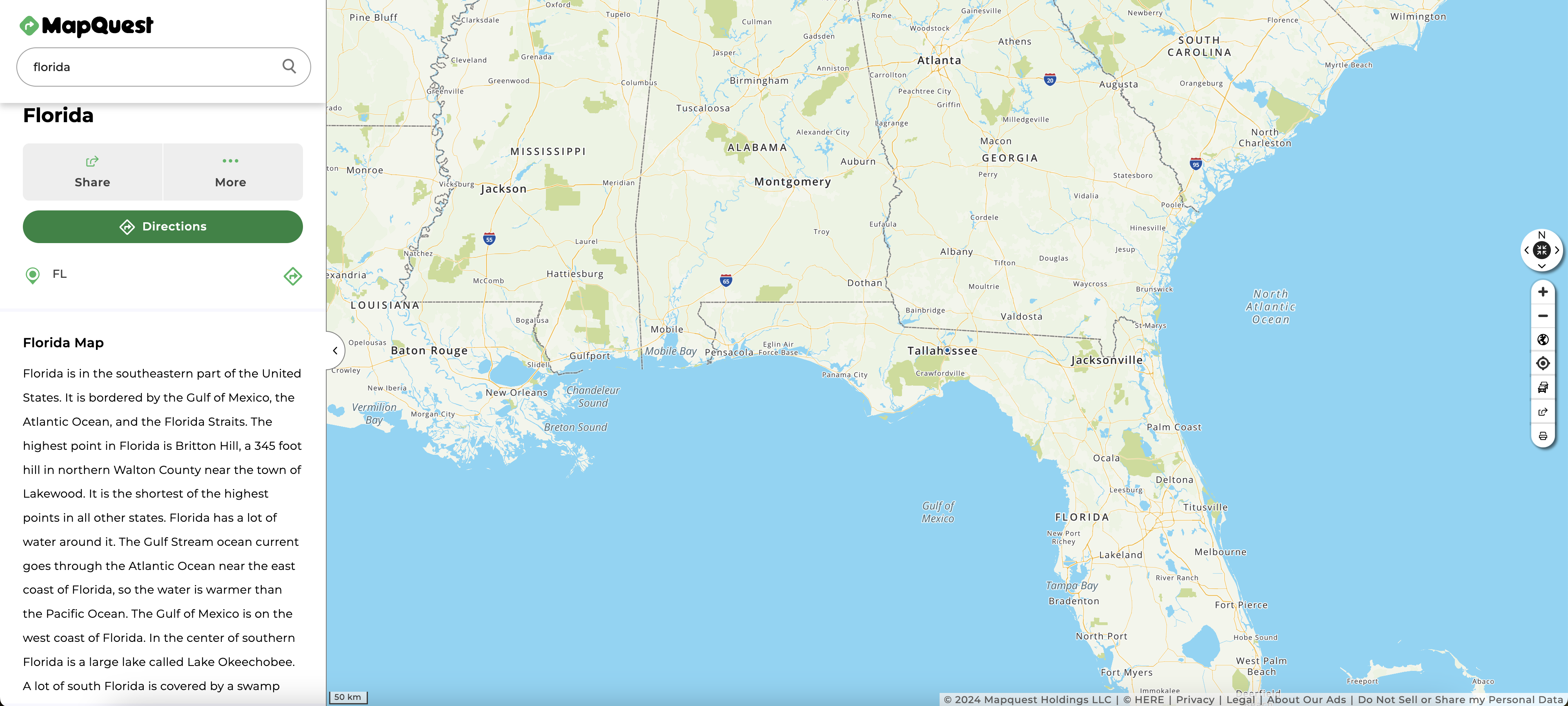
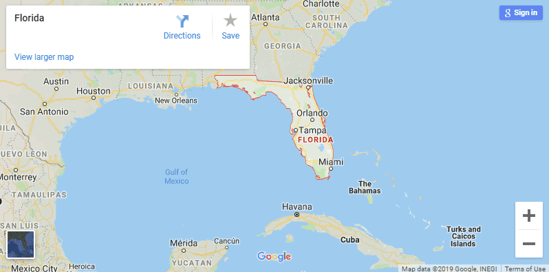
Welcome to the Maps of FLORIDA the most popular state of the United States of America (USA). Florida has 412 municipalities ( city + towns + villages), It has 283 cities, 109 towns, and 20 villages in the whole maps of Florida. The capital city of


A
- Alachua
- Alford
- Altamonte Springs
- Altha
- Anna Maria
- Apalachicola
- Apopka
- Arcadia
- Archer
- Astatula
- Atlantic Beach
- Atlantis
- Auburndale
- Aventura
- Avon Park
B
- Bal Harbour
- Baldwin
- Bartow
- Bascom
- Bay Harbor Islands
- Bay Lake
- Bell
- Belle Glade
- Belle Isle
- Belleair
- Belleair Beach
- Belleair Bluffs
- Belleair Shore
- Belleview
- Beverly Beach
- Biscayne Park
- Blountstown
- Boca Raton
- Bonifay
- Bonita Springs
- Bowling Green
- Boynton Beach
- Bradenton
- Bradenton Beach
- Branford
- Briny Breezes
- Bristol
- Bronson
- Brooker
- Brooksville
- Bunnell
- Bushnell
C
- Callahan
- Callaway
- Campbellton
- Cape Canaveral
- Cape Coral
- Carrabelle
- Caryville
- Casselberry
- Cedar Key
- Center Hill
- Century
- Chattahoochee
- Chiefland
- Chipley
- Cinco Bayou
- Clearwater
- Clermont
- Clewiston
- Cloud Lake
- Cocoa
- Cocoa Beach
- Coconut Creek
- Coleman
- Cooper City
- Coral Gables
- Coral Springs
- Cottondale
- Crescent City
- Crestview
- Cross City
- Crystal River
- Cutler Bay
D
- Dade City
- Dania Beach
- Davenport
- Davie
- Daytona Beach
- Daytona Beach Shores
- DeBary
- Deerfield Beach
- DeFuniak Springs
- Deland
- Delray Beach
- Deltona
- Destin
- Doral
- Dundee
- Dunedin
- Dunnellon
E
F
- Fanning Springs
- Fellsmere
- Fernandina Beach
- Flagler Beach
- Florida City
- Fort Lauderdale
- Fort Meade
- Fort Myers
- Fort Myers Beach
- Fort Pierce
- Fort Walton Beach
- Fort White
- Freeport
- Frostproof
- Fruitland Park
G
- Gainesville
- Glen Ridge
- Glen St. Mary
- Golden Beach
- Golf
- Graceville
- Grand Ridge
- Grant Valkaria
- Green Cove Springs
- Greenacres
- Greensboro
- Greenville
- Greenwood
- Gretna
- Groveland
- Gulf Breeze
- Gulf Stream
- Gulfport
H
- Haines City
- Hallandale Beach
- Hampton
- Hastings
- Havana
- Haverhill
- Hawthorne
- Hialeah
- Hialeah Gardens
- High Springs
- Highland Beach
- Highland Park
- Hillcrest
- Hilliard
- Hillsboro Beach
- Holly Hill
- Hollywood
- Holmes Beach
- Homestead
- Horseshoe Beach
- Howey-in-the-Hills
- Hypoluxo
I
- Indialantic
- Indian Creek
- Indian Harbour Beach
- Indian River Shores
- Indian Rocks Beach
- Indian Shores
- Inglis
- Interlachen
- Inverness
- Islamorada
J
- Jacksonville
- Jacksonville Beach
- Jacob City
- Jasper
- Jay
- Jennings
- Juno Beach
- Jupiter
- Jupiter Inlet Colony
- Jupiter Island
K
L
- LaBelle
- LaCrosse
- Lady Lake
- Lake Alfred
- Lake Buena Vista
- Lake Butler
- Lake City
- Lake Clarke Shores
- Lake Hamilton
- Lake Helen
- Lake Mary
- Lake Park
- Lake Placid
- Lake Wales
- Lake Worth
- Lakeland
- Lantana
- Largo
- Lauderdale Lakes
- Lauderdale-by-the-Sea
- Lauderhill
- Laurel Hill
- Lawtey Nour Town
- Layton
- Lazy Lake
- Lee
- Leesburg
- Lighthouse Point
- Live Oak
- Longboat Key
- Longwood
- Loxahatchee Groves
- Lynn Haven
M
- Macclenny
- Madeira Beach
- Madison
- Maitland
- Malabar
- Malone
- Manalapan
- Mangonia Park
- Marathon
- Marco Island
- Margate
- Marianna
- Marineland
- Mary Esther
- Mascotte
- Mayo
- McIntosh
- Medley
- Melbourne
- Melbourne Beach
- Melbourne Village
- Mexico Beach
- Miami
- Miami Beach
- Miami Gardens
- Miami Lakes
- Miami Shores
- Miami Springs
- Micanopy
- Midway
- Milton
- Minneola
- Miramar
- Monticello
- Montverde
- Moore Haven
- Mount Dora
- Mulberry
N
- Naples
- Neptune Beach
- New Port Richey
- New Smyrna Beach
- Newberry
- Niceville
- Noma
- North Bay Village
- North Lauderdale
- North Miami
- North Miami Beach
- North Palm Beach
- North Port
- North Redington Beach
O
- Oak Hill
- Oakland
- Oakland Park
- Ocala
- Ocean Breeze
- Ocean Ridge
- Ocoee
- Okeechobee
- Oldsmar
- Opa-locka
- Orange City
- Orange Park
- Orchid
- Orlando
- Ormond Beach
- Otter Creek
- Oviedo
P
- Pahokee
- Palatka
- Palm Bay
- Palm Beach
- Palm Beach Gardens
- Palm Beach Shores
- Palm Coast
- Palm Shores
- Palm Springs
- Palmetto
- Palmetto Bay
- Panama City
- Panama City Beach
- Parker
- Parkland
- Paxton
- Pembroke Park
- Pembroke Pines
- Penney Farms
- Pensacola
- Perry
- Pierson
- Pinecrest
- Pinellas Park
- Plant City
- Plantation
- Polk City
- Pomona Park
- Pompano Beach
- Ponce de Leon
- Ponce Inlet
- Port Orange
- Port Richey
- Port St. Joe
- Port St. Lucie
- Punta Gorda
Q
R
S
- Safety Harbor
- San Antonio
- Sanford
- Sanibel
- Sarasota
- Satellite Beach
- Sea Ranch Lakes
- Sebastian
- Sebring
- Seminole
- Sewall’s Point
- Shalimar
- Sneads
- Sopchoppy
- South Bay
- South Daytona
- South Miami
- South Palm Beach
- South Pasadena
- Southwest Ranches
- Springfield
- St. Augustine
- St. Augustine Beach
- St. Cloud
- St. Leo
- St. Lucie Village
- St. Marks
- St. Pete Beach
- St. Petersburg
- Starke
- Stuart
- Sunny Isles Beach
- Sunrise
- Surfside
- Sweetwater
T
U
V
W
- Waldo
- Wauchula
- Wausau
- Webster
- Weeki Wachee
- Welaka
- Wellington
- Westlake
- West Melbourne
- West Miami
- West Palm Beach
- West Park
- Weston
- Westville
- Wewahitchka
- White Springs
- Wildwood
- Williston
- Wilton Manors
- Windermere
- Winter Garden
- Winter Haven
- Winter Park
- Winter Springs
- Worthington Springs
Y
Z